Thursday, 14 May 2009

Day 37 - Lanark to Glasgow


The pics from top: My start on Clyde Walkway where M74 crosses the Avon; my shadow whilst walking; First sight of the Highlands across Strathclyde industry; landmarks seen as I entered Glasgow city centre.

Day 37 Monday May 11th. I had greatly enjoyed my rest day with Lindsey in the beautiful surroundings of New Lanark - everything had gone beautifully. John had walked half way to Glasgow with his pack, then taken the train in and relaxed in his hotel overnight. He then returned today, without his pack which is a lot easier on his legs, to the half way point and completed his walk.
I was held up till 8.30 as I needed the OS map of Glasgow for the route, but bought one at Smith's, then LIndsey dropped off, a little tearfully, at the Crossford Hotel fifteen minutes later. The first few miles were along the A72, which wasn't very nice, but there wasnt a lot of traffic and there was enough of a footway, or grass verge, that it wasn't dangerous. It was very difficult finding a way into Glasgow that would avoid too much urban and the first half of this walk was mostly on streets and main roads. I just yomped it, walking fast with hardly a break until I got to the RIver Avon (the Scottish version) which had a path along it that joined the Clyde Walkway at Motherwell. The Clyde Walkway tracks the twists and turns of the river, so I had worked out a route that leaves the river where there is a more direct and acceptable route. The Walkway is not as attractive as some paths we have been on by canals or rivers, as it is surrounded by industry for much of the way and the vegetation is very weedy, including Japanese Knot Weed in quantity. However, at MOtherwell, the path goes through past strathclyde Loch which is now a huge aquatic centre with lot of people running,cycling and walking as well as sailing and rowing. My route then took me through Bothwell and Uddingston, which are rather nice: red sandstone towns with lots of attractive buildings and a nice atmosphere.
There followed a bit of country, with views to the hills of the north over an industrial landscape, then a stretch of urban mess before I rejoined the Clyde Walkway at Cambuslang. The weather has been beautiful yesterday and today and got quite hot - it is extraordinary that on Sat afternoon, it was very cold and sleeting!
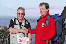
I suddenly got a call from the Baccleugh Hotel, where we stayed in Moffatt, saying they'd found my iPHone charge that I'd left there. It was Clint, one of their managers, who called and he said that since I was in Glasgow, he'd bring it to me! We arranged to meet an hour later on the A74 at a railway station. This meant that I had to divert from the relatively scenic Walkway to the main A74 trunk road into Glasgow which is anything but attractive. HOwever, it is very direct,so saved me a couple of miles. Clint arrived at the same time as I did, and gave me the charger, and I offered profuse thanks.
The walk into Glasgow along the A74 was very ordinary: a lot of redundant buildings, seedy looking bars and bookies and the Glasgow Celtic football ground. However, there was also evidence of quite a lot of urban regeneration in this east end of Glasgow that has always been the 'hard' end of town. As I approached the centre, however, things became much more vibrant, and there are a lot of very fine and interesting buildings throughout the city. Since it was cleaned up around the time when Glasgow was one of the first European Cities of Culture, Glasgow has really come alive and is now a lovely vibrant city with a sort of fun atmosphere - very different from its dour and industrial past.
By 5pm, I was at Central Station, where I located a B&B at Kelvin Grove right on our route for tomorrow and walked the last couple of miles there. Later on I happened on an Indian restaurant on Sauchihall Street called 'Mother India' that was extraordinarily good. Downstairs it is quite smart, but upstairs, it verges on the gothic, with dark wood and candelbras on the tables. The food is quite unique and excellent, so if you're in Glasgow, worth a visit.
The day was one big yomp - hard work and not a lot of fun, but I covered the 24 miles in 8 and a half hours which at least got it over with. Now we can look forward to The West Highland Way and some great scenery.

Sunday, 10 May 2009

Day 35 Abington to Crossford and New Lanark


The pictures from the TOP: On the moor above Abington; Coffee with Lee; power station where we crossed the Clyde; the Clyde walkway; New Lanark.


Day 35 - Saturday May 9th. This is my first wedding anniversary and it seems rather incredible that Lindsey and I will be reunited this afternoon, but wonderful. However, the morning did not look wonderful, infact, it looked a muckle drich (very bleak). The sky was leaden, rain was falling steadily and the trees were swaying in the wind. Another annoyance was that I had lost my iPhone charger - I thought I must have left it in the wall at the Moffatt hotel, but they said they couldn't find it, which is very odd and more annoying. I use it a lot to keep in touch with family and friends, and to post Twitters, find accommodation, pick up my emails and send them. It means I'll have to buy another in Glasgow. The trouble is that I have so many bits of wire and plastic for the technology I'm carrying that it is very difficult to ensure that I have everything when we leave a place. Must be more careful!
We set off in reasonable conditions - intermittent showers and a wind mostly at our backs. Even the Scots think it's terrible weather for May, but they do say that it will improve at from this afternoon. We continued up the Clyde valley for a while on the A73 Lanark road, more nice views of the windswept river winding into the grey distance. There were a couple of brave souls fishing. We turned north, climbing up onto the moors of the Douglas and Angus Estate where sedge and heather covered the boggy hillsides. We climbed steadily on a very quiet road up to nearly 1,200 feet, where the wind was cold and strong. We tried to take a break on a bridge looking down a wide valley to grey hills beyond but it started to rain. Soon after, we turned north, and the wind and rain really picked up, so it was a bit of a slog for a few miles up the little road until we reached a pine forest which lent some protection from the wind. The views were at times extensive, and had their drama, but we'd have seen a lot more had it been clear.
Borders farms and villages tend to be very well maintained and tidy, so it was surprising to come across some junk, fly tipping and a house surrounded by junk in this remote location: we wondered why someone bothers to move to a location like this only to trash their immediate vicinity.
We turned north again, descending towards Douglas Water, a tributory of the Clyde and a small town called Rigside which seems to be associated with an open-cast coal mine in the valley. Our route took us to the east of these, over attractive farmland, but the weather got worse: colder, with sleet among the heavy rain and more windy. We had done 12 miles and really needed a rest, particularly as John's leg was continuing to niggle. We crossed Douglas Water on a bridge, beside which was a property with a veranda and two comfortable looking chairs that were protected from the weather. I went and rang the doorbell, and I asked the lady if we could take a rest on her seats. She immediately said yes, and followed it up with an offer of a drink. We were very relieved to get out of the wind and rain for a bit and take the weight off our feet, then Lee MItchell came out to us with coffee, which warmed us and refreshed us considerably. The veranda we were on was within a holiday home that they let out over the summer, looking right over the river. She and her husband work in Hamilton and both love walking, in fact Ian was contemplating doing LEJOG.... one day.
We left there with lifted spirits, which were needed as the weather was by then atrocious. This was very unfortunate as the countryside is quite lovely with lots of variety and colour and good views. As the afternoon wore on, John's leg was really troubling him, but he kept going, albeit little gingerly. We had to descend to the Clyde and there was supposed to be a footpath across a farm which was not apparent. The farmer, who looked and sounded a bit like a better looking Rab C Nesbitt, said that it was there but probably too slippery in this weather, so we took the road. This joined the busy and twisty A72 which we had to follow carefully for about 600 yards before turning off steeply downhill to the little hydro-electric power station at the bottom. There was a bridge across the river, which was flowing very strongly, but I couldn't find a way out. I rang the bell on the main entrance, and a kind man said that we could get through by climbing up some steps then following the fence around to an 'unofficial' access point onto the Clyde Walkway. As we climbed, the rain stopped and the sun came out! The last two miles were walked in brilliant weather, with the sun shining through the beech trees that were just coming into leaf. Beech trees in the sun in springtime are one of natures wonders, with their smooth grey trunks and leaves that seem to fluoresce with a lovely warm green against a blue sky. The river, fields and bluebells were sparkling and we were surrounded at times by sheets of white wild garlic.
We finished a bit later than planned because of the weather and giving John's leg a chance, but Lindsey was waiting for us in Crossford and we were soon driving down through gorgeous scenery to New Lanark, where we were booked for the night. Lindsey and I were staying in the hotel, which is quite smart, whilst John had booked himself into the YHA as he was heading off again early in the morning (he wasn't too impressed by the experience!) New Lanark was essentially a cotton mill harnassing the power of the Clyde, built in the nineteenth century by industrialist David Dale. His son in law, Robert Owen, enlarged the place adding tenemants for the workers and a school, medical centre and other facilities. He was very enlightened and made it into a real mutually dependent community. The mill only closed in the late 60s, but the buildings are well designed and constructed in a really lovely location, surrounded by forest in the deep Clyde valley, next to some spectacular waterfalls. Therefore, the site was renovated and new, mostly leisure, uses found for the buildings which now include our accommodation for the weekend.
I was very happy to be with my wife, even if only for a short break. No walking tomorrow: hooray!

Friday, 8 May 2009

Day 34 Moffatt to Abington


Pics from the bottom up - Wet start in Moffatt; Damp morning in the borders hills; first view of the Clyde River.

Day 34 - Friday May 8th. The weather forecast was for heavy showers and rain in the morning, becoming increasingly windy during the day, and it was bang on the nail! This turned what we thought would be quite a tame walk into a bit of a battle with the weather as we struggled against a north-westerly head wind for much of the way: very tiring. After a very nice breakfast, which included haggis, we set off just after 9am through a rain-swept Moffat, then keeping to a minor road at first that was very quiet. John's leg was a bit sore but not getting worse as long as he kept to his own pace and we made good progress. All of the streams were running fast, and the wind was swaying the tree tops, but it wasn't too bad for us at this point. There was a short stretch on a farm track which became less defined as it wandered into the grassy hills, but it wasnt too long before it took us up to the A701. A minor road left this and took us between dark pine forests over the hill tops and it was rather a nice change of scenery for a while, with the sound of the wind in the trees in the background.
Our route then descended gradually into valley that contains the M74, main rail line and the old A74 which has become a bike route as well as a B road, and the noise grew as we got closer. The wind also grew, and from that point on, walking alongside the M74 was at times very hard work, with a head wind pushing us back and buffetting us, and longish rain showers, mixed with hail at times. Not very pleasant. Around lunchtime, the rain started to clear and we got some sunshine, but the wind picked up so it was sometimes quite difficult to walk. However, we both made steady progress along the cycle track. The first part of the walk up the valley was gently uphill, and the sides were covered in pine plantations, but as we entered Lanarkshire, these petered out and we started to go downhill with high bare hills with big valleys going off to the east and west. We had at that point come over a col into the Clyde Valley, which we will follow into Glasgow now. The Clyde is a young river here, fast flowing and shallow, through a countryside with wide open views.
After 15 miles, Crawford was the first settlement sitting between the motorway and the river where local services were signposted. However, this is a village that has not gained business from passing traffic as the the two hotels were closed, there was no fuel, but it did have an open shop where I bought a pie to keep me going. It was a couple miles more to our destination, Abington, which has a bit better set up, with an open hotel and situated in a wooded valley. The hotel is nice enough but was very quiet, so in the evening I spent an hour or two practising Scottish songs instead of playing for others.
Sadly the weather forecast for tomorrow isn't very good.
TOMORROW it is our first wedding anniversary and Lindsey is coming up for us to celebrate togther at New Lanark, so I'm have a DAY OFF!!! Hooray! So no post for Sunday.
John is going to walk on to Glasgow on Sunday and spend monday relaxing in a very good hotel, then we'll meet up on Tuesday morning to start the West Highland Way.

Day 33 Lockerbie to Moffatt


These pics are (from the bottom): In the hills above Lockerbie, Moffatt, Scenery en route to Moffatt.

Day 33 - Thu May 7th. The rain continued into the evening, but the morning brought broken cloud with no precipitation, but it was still windy and cold for May (mind you, the Scots always say that - "Och it's offa cauld the day: ye should've been here...."). After breakfast I went on a hunt for a new fleece - mine was very old and it had suffered on this trip and Lindsey hates it . The only place open that sold them was the agricultural shop at the end of town, but the only one that fitted me was a ghastly brown. I bought it anyway as the best available,and it was cheap, but Lindsey will hate it even more. Lockerbie centre is built of read and grey stone, very much in the Scottish style, but has a rather dark atmosphere. It sits in the broad valley of the River Annan and has one of the most northerly Roman camps on its outskirts. It has the misfortune of having gained fame because of the aircraft bomb, but is otherwise a centre for this agricultural area and a staging post between Scotland and England.
We walked northwards out of town following a stream gradually uphill through attractive farmland with hills rising behind. This is charming countryside with views ever changing from fields to little woods, to great dark forests, tumbling streams and high bleak moorland. It is quite sparsely populated and all habitation in concentrated in the valleys with wide areas of inhospitable hills between. However we have learned that, although people are not concentrated in villages, there is a great sense of community and quite a lot going on if you can be bothered to find it.
The roads we were on got smaller and higher, and the land rougher, until the tarred road petered out and became a farm track. At that point, we met Willie, a huge local farmer who was setting up some pens on his land. He had an accent more akin to Donald's in Longtown than to Scotland and he told us that most of the farmers in the area came from England or Ireland! The farm track led through a hill farm who's fields were broken up with ponds and boggy areas, and the hills rose up steep and round in all directions. Sadly the views were somewhat disrupted by power pylons again that crossed and dominated the landscape sometimes.
A pain in John's left leg had been niggling since yesterday, and I was quite concerned. He was taking ibuprofen and continued walking at a good speed, but was not comfortable. We stuck close together in this remote country in case it became a serious problem, but I can now report that he did finish today's walk and feels a bit better, so fingers crossed for tomorrow!'
The weather cleared up as the day wore on, so we had a really beautiful, if breezy, afternoon descending back into the Annan valley towards Moffatt through a lovely combination of little corners of charm and beauty and wide landscapes rising up to distant hills. It was quite fun looking down on the M74 and mainline railway from a the calm of a quiet country road. Most of the farms in this region are beef, milk and sheep and some of the beef cattle are extraordinary - great beasts of pure muscle quietly sitting in muddy field chewing their cud. There are also some enormous commercial softwood forests that stretch for miles and miles, casting their dark stain over the high hills, dense and silent.
Moffat is a nice little town on the banks of the Annan, full of very Scottish buildings and shops with amusing names, like the cafe called 'The Rumbling Tum' (it does excellent scones or toasted tea cakes with a pot of tea). It is much more open and lighter than Lockerbie and the large number of hotels is testament to it's popularity. Our starter at dinner was Arbroath Smokies, apparently done in the authentic style. This is small smoked haddock cooked in a creamy sauce with an egg on top, and it was rather good.

Wednesday, 6 May 2009

Day 32 - Longtown to Lockerbie


Day 32 - Wed May 6th. The day dawned brightly, but was to deteriorate. Longtown has a lot of character and is quite different in appearance from the stone-built Cumbrian towns further south, being comprised of little painted houses neatly arranged along wide streets. After breakfast, we were off at 8.30 across the Esk on the Graham's bridge. You can see how shallow the Esk is here, but when it has been raining it flows fast and there are folk songs about people getting swept away. A short way up the A7, we left it joining a minor road that headed for the Scottish border at Sark House where a bridge crosses the little River Sark. We were very disappointed that there was no sign at all of the border, which may reflect the uncertainty of the 'Debatable Lands'. Anyway, we walked in step to ensure we crossed the border at the same time and felt it to be a serious landmark on our journey.
The countryside was still flat farmland and not very interesting, but gradually started to rise as we passed through the hamlet of Chapelknowe. We reached a place called 'Kennedy's Corner' which consisted of a road junction and 3 houses, one of which had a covered seat in the front yard. I knocked on the door to ask for permission for us to sit there for a bit, and the lady, who's name turned out to be Kate Johnson, immediately invited us in for coffee! This was brilliant as we had done 10 miles and it was exactly what we wanted. We sat in her kitchen and chatted with her - she is an IT instructor for teachers in the region and recovering from illness, which is why she was at home. It absolutely made our day.
The countryside was now lovely - hilly with stretches of woodland, moorland, fields and rivers. It was a bit spoiled by the deteriorating weather, which turned what could have been a very enjoyable day's walk into a serious yomp against the elements. As we turned towards the west on a B road with 10 miles to Lockerbie, we were hit by a rain driven by a strong head wind that gusted strongly enough to knock us sideways especially in the more exposed places. There were no villages with anywhere to sit down and rest in the rain, so it was very hard work. At least the scenery was pleasant, and one bright point was a pair of gold finches that flew around each of us as we battled the elements. We were very glad to arrive in Lockerbie.
This evening we met some Californians who are doing LEJOG in instalments, coming over twice a year to do another section. They have followed a route with a lot of similarity to ours so we had some fun comparing notes, then early to bed very tired.


Day 31 - Southwaite to Longtown


Day 31: Southwaite to Longtown. We were up and out of Southwaite as soon as we could be, planning to have breakfast in Carlisle, 6 miles or so down the road. The weather was dull and a bit drizzly, just like yesterday and we continued on the same straight road for a further 3 miles, so iPod music came in handy again. Walking in through the suburbs of Carlisle I was struck again with how similar places look wherever you are - I suppose it means that these sorts of streets and houses work. John and I don't like that fact that it is also the shops that often look identical, with the same logos wherever you go. It's nice that many smaller towns we are coming across do still have their locally owned shops, which gives a place more of a character.
It wasn't a very good day to see Carlisle, which looked grey like the weather, and we didn't have time to explore the castle and so on, but this is a very historic city and was a centre for the Romans, Scottish King David I, and possibly for King Arthur (see below). A question that was turning over in my mind was, why are there so few villages to the north and south of Carlisle - we had walked for many miles encountering a single small village and there are none to the north until Longtown.
We had breakfast in a cafe in the centre then continued on our way, leaving the city on the A7. John has had a persistent cough since his cold earlier on the walk and it was getting him down a bit, so we managed to drop into a medical practice as we passed it, and a doctor saw him straight away! Very fortunate. He's OK, which was reassuring, and has a prescription in case it gets any worse.
Walking on A roads like this is not pleasant - the big trucks are very noisy and rather intimidating and you get a huge wind as they pass, along with the diesel exhaust. Eventually, we left the town behind on a lane that went past an enormous National Grid relay station, with power pylons striding out from it in all directions. Again there were almost no footpaths, villages or settlements apart from farms and isolated houses, and little to look at apart from fields, sheep, cattle and the odd horse. (there are an AWFUL lot of sheep in Britain!). I asked four people I encountered and asked them if they knew why the area was so empty, and got no satisfactory answer. It wasn't until the approaches to Longtown that we came across a church at last, and rather a handsome red sandstone one. This was St Michael and All Angels at Arthuret, and here answers to my questions started to come. The church brochure says that it "was sited in a very troubled area and sufered through several centuries mainly due the lawlessness of the Border Reivers between 1300 and 1600, and the battle of Solway Moss took place in 1542 near the church. It was only unification under King James that brought peace to the area. This, and arguments about exactly where the border between Scotland and England should run meant that people kept clear of the area and it was left largely alone. The name of the Parish of Arthuret seems to be associated with a battle in the 6th century when the Chistian King of Cumbri defeated the pagan King Of Scots, and St Mungo became bishop in Glasgow. However an alternative legend is that Carlisle was in fact Camelot, and Arthuret is derived from King Arthur's name, and was strongly associated with Merlin. There is an effigy of King Arthur rather strangely placed in the church, which otherwise is rather magnificent, with gorgeous stain glass windows and a huge well-maintained graveyard, where all the old grave stones are of red sandstone.
We stayed at the Graham Arms Hotel in Longtown, which is a nice unpretentious place. The Grahams are the big local family and have been responsible for much of the development of the place over the years, including the bridge over the River Esk. The reason Longtown is here, and is the only settlement, is that it was the first point at which the Esk was crossable. The border is generally situated on the Esk, except here where it runs north-east along the tiny River Sark, then south-west on the 'Scots Dyke', which was specially built for the purpose: these are the 'Debatable Lands'. People told me that if you were on the English side of this border, you speak with a Cumbrian accent, but anyone on the other side will speak with a Scottish accent. I was helped greatly with this, and other, knowledge about this region by Donald Benson in the bar that evening - fascinating stuff.

Tuesday, 5 May 2009

DAy 30 - Bampton to Southwaite


Day 30 Mon May 4th. A dull and damp bank holiday Monday was forecast, which we didn't mind too much as we had two days of relatively flat, low terrain to come. In the event it drizzled for most of Monday and was very overcast, but the forecast heavy rain didn't materialise, in which we counted ourselves lucky.
John was refreshed after a long sleep, but still coughing, and I felt fine in spite of a relatively short night following the evening's activities. The countryside to Penrith was pleasant, with dry stone walls and villages built of limestone, but any views of distant hills were shrouded in the grey blanket of cloud. Penrith is high up above the Eden Valley on the edge of the Eastern Lake District: its climate tends to be cool and damp and today was no exception. However, the town was in the midst of the Mayday Fesival and there was a fairground, mummer's plays being performed along with other local performances, and preparations for a grand procession in progress. We enjoyed an amusing play about Robin Hood, and an excellent brass band performing in the lovely church, and also the line of vintage cars.
After a coffee and tea cake, we set off for a very uninteresting afternoon's walk on very very long straight lanes through fields of sheep and cattle to Southwaite services on the M6. We both had our iPods at work, keeping us entertained as there was precious little to see as we tramped away the miles. I stopped and talked to a lady who was walking her playful labrador, who runs a day nursery in Penrith, but otherwise met no-one.
We were relieved to arrive at our destination, but were fairly appalled at the services offered - the only reason I had selected this was that Carlisle was too far for a day's walk and I couldn't find any alternative accommodation in the vicinity as there is single village and farms, and nothing else. The Travelodge was even worse than the last: they only had 'family' rooms, which turned out to have one double bed and a sofa with bedding supplied. The place looked quite scruffy and everything is stripped to the bone: they even only supplied 2 hangers for clothes. We felt that the company had lost sight of it's original purpose, to provide good value, pleasant places to stay and instead the accountants were running the show looking to make money out of it's customers wherever it could. It was clean and adequate, however, but we were further dismayed to find that the entire site was alcohol-free with no pubs nearby, and the only food was Burger King, a small range of cafeteria food and an M&S outlet. So dinner was an M&S salad followed by a burger eaten out of its bag at a table in the services.
After that, we retired to our room and occupied ourselves with planning until 10 when we turned in. As mentioned before, we have developed a clear vision of what we are doing, which is to complete this challenge as quickly and pleasantly as possible, but that means that, rather than always taking the scenic route, we will take the direct, boring route where there is a clear advantage. As a result, it now looks as though we can complete the journey before the end of May, which we, and our wives, will be very pleased about, and days like this are just part of getting the job done.