


Day 31: Southwaite to Longtown. We were up and out of Southwaite as soon as we could be, planning to have breakfast in Carlisle, 6 miles or so down the road. The weather was dull and a bit drizzly, just like yesterday and we continued on the same straight road for a further 3 miles, so iPod music came in handy again. Walking in through the suburbs of Carlisle I was struck again with how similar places look wherever you are - I suppose it means that these sorts of streets and houses work. John and I don't like that fact that it is also the shops that often look identical, with the same logos wherever you go. It's nice that many smaller towns we are coming across do still have their locally owned shops, which gives a place more of a character.
It wasn't a very good day to see Carlisle, which looked grey like the weather, and we didn't have time to explore the castle and so on, but this is a very historic city and was a centre for the Romans, Scottish King David I, and possibly for King Arthur (see below). A question that was turning over in my mind was, why are there so few villages to the north and south of Carlisle - we had walked for many miles encountering a single small village and there are none to the north until Longtown.
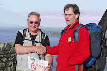
We had breakfast in a cafe in the centre then continued on our way, leaving the city on the A7. John has had a persistent cough since his cold earlier on the walk and it was getting him down a bit, so we managed to drop into a medical practice as we passed it, and a doctor saw him straight away! Very fortunate. He's OK, which was reassuring, and has a prescription in case it gets any worse.
Walking on A roads like this is not pleasant - the big trucks are very noisy and rather intimidating and you get a huge wind as they pass, along with the diesel exhaust. Eventually, we left the town behind on a lane that went past an enormous National Grid relay station, with power pylons striding out from it in all directions. Again there were almost no footpaths, villages or settlements apart from farms and isolated houses, and little to look at apart from fields, sheep, cattle and the odd horse. (there are an AWFUL lot of sheep in Britain!). I asked four people I encountered and asked them if they knew why the area was so empty, and got no satisfactory answer. It wasn't until the approaches to Longtown that we came across a church at last, and rather a handsome red sandstone one. This was St Michael and All Angels at Arthuret, and here answers to my questions started to come. The church brochure says that it "was sited in a very troubled area and sufered through several centuries mainly due the lawlessness of the Border Reivers between 1300 and 1600, and the battle of Solway Moss took place in 1542 near the church. It was only unification under King James that brought peace to the area. This, and arguments about exactly where the border between Scotland and England should run meant that people kept clear of the area and it was left largely alone. The name of the Parish of Arthuret seems to be associated with a battle in the 6th century when the Chistian King of Cumbri defeated the pagan King Of Scots, and St Mungo became bishop in Glasgow. However an alternative legend is that Carlisle was in fact Camelot, and Arthuret is derived from King Arthur's name, and was strongly associated with Merlin. There is an effigy of King Arthur rather strangely placed in the church, which otherwise is rather magnificent, with gorgeous stain glass windows and a huge well-maintained graveyard, where all the old grave stones are of red sandstone.
We stayed at the Graham Arms Hotel in Longtown, which is a nice unpretentious place. The Grahams are the big local family and have been responsible for much of the development of the place over the years, including the bridge over the River Esk. The reason Longtown is here, and is the only settlement, is that it was the first point at which the Esk was crossable. The border is generally situated on the Esk, except here where it runs north-east along the tiny River Sark, then south-west on the 'Scots Dyke', which was specially built for the purpose: these are the 'Debatable Lands'. People told me that if you were on the English side of this border, you speak with a Cumbrian accent, but anyone on the other side will speak with a Scottish accent. I was helped greatly with this, and other, knowledge about this region by Donald Benson in the bar that evening - fascinating stuff.

No comments:
Post a Comment