


Day 19 - Thusday 23rd April. Our full packs were waiting for us in our pleasant rooms at The George and Dragon pub, so packing was a bit more complicated than it had been for a number of days. We also had some reservations about how the day would go on the hills with all our kit on our backs. It was cloudy and cool again but with the promise of sunshine later. Knighton is built on steep land and the main street was quite a climb up to the clock tower and beyond. We then passed the Offa's Dyke information centre (closed) and down to a footpath which crossed the River Teme and then joined a minor road northward.
We had decided again to save time and our legs by using the road for the first few miles as it avoided a very steep climb, so it was an easy start overlooking the river valley, then up a valley to rejoin the pathway, which we followed for the rest of the day. Offa's Dyke often follows a pretty straight route north-south and was built up and down very steep hillsides in some places. Where it is still visible, which is for most of it's length in these parts, it consists of a ditch on the west (Welsh) side and an earth wall on the east side. These must have been steeper and deeper in the past as they don't look like much of a defence now, but apparently they were reinforced with spikes in the walls and thorns in the ditch. I could not imagine how men without steel tools could have built something so huge, nor how it could have been defended.
Whilst we were up on the hills, it was very pleasant walking in the hazy sunshine along the dyke or next to it, on a wide track or on springy turf. There were also deep valleys to descend to and climb from, sometimes on a very steep incline, which were hard work with our packs. However we managed OK, so perhaps are getting fitter.
We encountered a handful of walkers during the day but the byways and paths are really very empty; Offa's Dyke is walked regularly however, and is well maintained currently. This is much less likely to continue when government spending dries up in the years to come - I suspect it will result in general neglect as there are too many other priorities on spending.
At a hamlet called Mainstone in one of the deep valleys, we encountered a very pretty little church in a well-maintained churchyard in which there were writings on display by a certain vicar named C.Drinkwater. There was a stone that had been placed on a bit of carpet near the pulpit, but I have yet to discover its significance except that this seems to be the source of the settlement's name.
After some 15 miles, we climbed to the summit of the last hill and from there could see a long way north into Shropshire and Clwyd, with the Long Mynd to our right. After that, it was a long steady descent from the hill to the fields and villages below. We passed through the grounds of Mellington Hall, still on the actual dyke but through some very pretty woods with wild flowers in abundance. Mellington seems to be set up as a leisure park, with a caravan park, restaurant and other facilities provided.
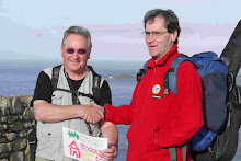
The last 5 miles were rather long, still following the visible dyke, but over flat intensively farmed fields with endless stiles in our way. We finally arrived at our destination after 6.30 and were very glad to be picked up by John Frost and whisked off for a couple of pints of beer, followed by showers and dinner. 21 miles and over 4,000 feet of climb today.

No comments:
Post a Comment