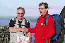

We were back to the St Agnes Hotel at 8.30 am and soon on the road. St Agnes is a town built on tin and lead mining and you can see the engine houses and smoke stacks dotted all around. There is no mining now but there are many shafts and workings so whole areas are fenced off with signs warning about the danger of hidden holes in the ground. Now they are quite picturesque, but a hundred years ago, this must have been a hard and smoky place. St Agnes climbs up a valley from the see so the roads tend to be steep and narrow and not made for motor vehicles.
We emerged onto the heath at the top of the village to the north then past the Wheel Kitty mine and down Trevellas Coombe with further workings at the bottom. Here we joined the coast path once more and climbed up to the cliff top where we were to walk for most of the day with the breeze at our backs and distant views under a blue sky.
The views from the cliff tops today were truly spectacular in the clear air: you could see right back to our base in
We passed a lot of old tin workings – apparently some of these go down several hundred feet, then extend under the sea for several kilometres. As we looked out, the sea and the sky were deepest blue: if you stroll around the art studios in St Ives you may feel that the artists are exaggerating the colours but, on a day like this, they are not. The colours are vivid.
In the mid morning, we decended to Perranporth then struck out along Penhale Sands which run for nearly 3 miles with a huge area of dunes to the landward that rise up to 200 feet. We were shocked by the amount of flotsam strewn across the sand at high tide mark – plastic bottles, trays, containers, fragments along with ropes, fishing gear and so on.
At the northern end of the bay we had to climb steeply up to the army road, which we followed around the training base situated there and passing a group of trainees being lectured on map reading. This was a bit of diversion from the planned route and we only arrived in Newquay at 1.30 – a bit later than planned. Newquay is an edgy town, and on the way in we encountered a drug dealer giving a client a hard time and some fearsome looking dogs. We stopped and bought a pasti and sat down on a bench overlooking the sea to eat it. Half way through mine, a seagull dumped on my head and astonishing quantity of poo, which went everywhere – very unpleasant and it took some cleaning up! John was vastly amused by the way I go so irate and offended by it.
During the afternoon, we navigated out of Newquay, over Porth beach and up to the cliffs again and the sun and the breeze and the views. It was quite a walk, so as we approached Mawgan Porth I thought I saw a short-cut through a field which, inevitably, turned into a rather long-cut and wasted some time and energy owing to impenetrable hedges. From Mawgan Porth, it was a slog up roads and round an RAF signals base that we had to skirt around, passing the lonely St Evals Church. This has a huge tower and sits atop the peninsula, but had no other buildings around it. Then we anticipated a quick walk across some fields and lanes to meet our lift home. We were completely stumped at Trevisker Farm, where the owner seems to have completely blocked the path off making it impossible to proceed. Very frustrating when you are tired and there is no good alternative (another grumpy old man moment for me). So I phoned Lindsey and changed the meeting point where we ended the day at 5.40pm. This gives us a longer and less interesting day tomorrow.
Tonight it’s POURING with rain, but the forecast is quite good.


No comments:
Post a Comment